To turn “that spot” into a repeatable harvest, use GPS waypoints to precisely mark productive foraging locations. Guarantee your device has accurate, up-to-date maps and add notes or photos for easy recognition. Share your waypoints with trusted friends to improve coordination and build a reliable database of spots. Properly managing these digital breadcrumbs makes returning easier and more efficient. Keep exploring to learn how fine-tuning your system can boost your foraging success even further.
Key Takeaways
- Use accurate, up-to-date GPS devices and maps to reliably mark productive foraging spots.
- Add detailed notes and photos to waypoints for easy identification during future visits.
- Share waypoints with trusted collaborators via cloud or QR codes to coordinate and optimize harvesting.
- Create digital breadcrumbs by consistently labeling and managing waypoints to build a revisitable trail.
- Combine mental maps with GPS data to develop a strategic, repeatable foraging routine for better success.
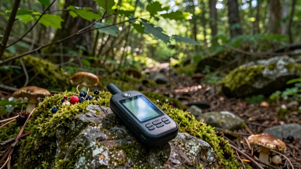
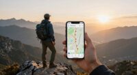
Have you ever struggled to find the best foraging spots or lost track of your route in the wild? If so, you’re not alone. Without a reliable way to mark and revisit those productive locations, it’s easy to waste time retracing your steps or missing out on prime harvests. That’s where GPS waypoints come in. They can turn that one good find into a repeatable harvest, as long as you understand how to use them effectively. One of the most important aspects is map accuracy. When you’re in the field, you need your GPS device to provide precise location data. Poor map accuracy can lead you to miss your target area or end up wandering aimlessly. Investing in a good quality GPS unit with up-to-date mapping ensures your waypoints are reliable. It’s also wise to verify the accuracy of your device’s maps before heading out, especially if you’re exploring less-traveled or remote areas. Once you’ve pinpointed a fruitful spot, sharing waypoints with fellow foragers can be a game-changer. Waypoint sharing allows you to exchange precise locations with trusted friends or group members, making it easier to coordinate trips and avoid redundant searches. Many GPS apps and devices support easy sharing, whether through cloud services, QR codes, or simple text files. It’s a smart way to build a collective knowledge base of productive foraging sites. When you mark a waypoint, you’re creating a digital breadcrumb trail that you can follow back to the same spot, even after weeks or months. This consistency saves time and energy, letting you focus more on harvesting rather than searching. To maximize your success, always double-check that your waypoints are correctly saved and labeled with relevant details—like what you found there or the best season to visit. Some devices even let you add notes or photos directly to a waypoint, providing extra context that makes revisiting easier. Remember, the key to turning “that spot” into a repeatable harvest lies in maintaining accurate, detailed, and shareable waypoints. As you gain experience, you’ll start to develop a mental map complemented by your GPS data, improving your foraging efficiency. With reliable map accuracy and effective waypoint sharing, you’ll be able to confidently revisit your favorite spots, knowing you’re returning to productive, well-documented locations. This approach transforms foraging from a random search into a strategic activity, helping you gather more with less hassle. In the end, mastering your GPS waypoints means more than just marking locations—it’s about turning each successful trip into a reliable, repeatable adventure. Understanding map accuracy is crucial because even minor discrepancies can lead to significant differences in the field, affecting your overall success.

Handheld GPS for Hiking, Rugged and Waterproof Handheld GPS Navigator, 3.2" Sunlight Readable Screen, Compact Satellite Handheld GPS with USA Topo Map, Multi-GNSS Support, Extra Battery Life
Compact and lightweight GPS handheld navigator boasts an anti-slip design offering a bright 3.2" screen that is sunlight...
As an affiliate, we earn on qualifying purchases.
Frequently Asked Questions
How Accurate Are GPS Waypoints in Dense Forest Environments?
GPS waypoints in dense forests can be quite accurate, but satellite signals often weaken due to tree interference. You might notice slight deviations, especially under thick canopy cover. To improve accuracy, use a high-quality GPS device, keep your receiver clear of obstructions, and update your firmware regularly. While not perfect, with these steps, you can reliably mark and revisit foraging spots despite the challenges posed by dense trees.
Can I Share Waypoints With Other Foragers Easily?
Yes, you can share waypoints with other foragers easily using sharing methods like GPS apps, messaging, or cloud storage. Just guarantee waypoint security by using encrypted platforms or password protection to keep your locations private. When sharing, double-check coordinates for accuracy, and communicate any notes or conditions. This way, you maintain control over your foraging spots while helping others find reliable harvest locations efficiently.
What Devices Are Best for Recording and Navigating to Waypoints?
You’ll want a device with reliable waypoint storage and rugged durability, so it doesn’t quit when you need it most. The Garmin GPSMAP series or Garmin eTrex models excel here, offering sturdy builds and excellent waypoint management. Sure, fancy smartphones might seem tempting, but they often lack durability and precise navigation features. Invest in a dedicated GPS device designed for outdoor use, so you can find “that spot” every time.
How Do Weather Conditions Affect GPS Accuracy During Foraging?
Weather conditions can substantially impact your GPS accuracy. Atmospheric interference, like heavy rain, snow, or thick cloud cover, can disrupt the satellite signal, causing your device to lose precision. When the sky is obstructed or weather is severe, expect some drift in your location. To minimize errors, wait for clearer conditions or use devices with enhanced signal processing. Keep in mind, consistent weather improves GPS reliability during your foraging trips.
Are There Legal Restrictions on Marking Foraging Locations?
You need to know that legal considerations and privacy concerns can seriously restrict your ability to mark foraging locations. Some areas have strict rules against recording GPS waypoints, especially on private land or protected sites. Ignoring these restrictions could lead to fines or trespassing charges. Always research local laws and respect privacy boundaries before marking spots. Staying informed guarantees you enjoy foraging responsibly without risking legal trouble or invading someone’s privacy.

Garmin eTrex® Touch, Rugged, Easy-to-Use GPS Handheld Navigator, Color Touchscreen, Preloaded Maps with Routable Trails and Roads, Long Battery Life for Hiking and All Outdoor Activities
Compact and lightweight GPS handheld navigator with bright 3" high-resolution color touchscreen so you can easily swipe and...
As an affiliate, we earn on qualifying purchases.
Conclusion
Next time you stumble upon a promising foraging spot, save that GPS waypoint. It’s funny how, months later, you return and find that “just a random patch” is still teeming with treasures, almost as if the universe arranged it just for you. Turning “that spot” into a repeatable harvest isn’t luck—it’s planning. With your GPS in hand, you’ll always have a secret spot ready, making foraging more rewarding and, surprisingly, more connected to those small, serendipitous moments.

Handheld GPS for Hiking, Rugged and Waterproof Handheld GPS Navigator, 3.2" Sunlight Readable Screen, Compact Satellite Handheld GPS with USA Topo Map, Multi-GNSS Support, Extra Battery Life
Excellent Satellite Support: Access Multi-GNSS navigation satellite systems (GPS+GALILEO+BEIDOU+QZSS) for improved position accuracy,location precision withih 5 ft, allows...
As an affiliate, we earn on qualifying purchases.
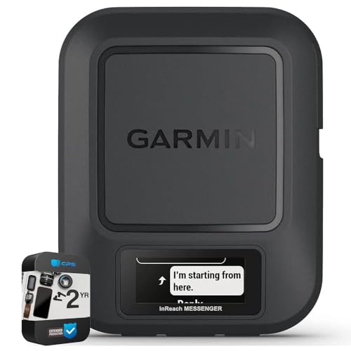
Garmin 010-02672-00 inReach Messenger Handheld Satellite Communicator Global Two-Way Messaging | Official USA Partner Model | Bundle with 2 YR CPS Enhanced Protection Pack
Garmin inReach Messenger Handheld Satellite Communicator Global Two-Way Messaging
As an affiliate, we earn on qualifying purchases.