To navigate coastal charts and tide tables effectively, start by familiarizing yourself with standard symbols for buoys, lighthouses, depths, and hazards on the chart. Always check tide tables for high and low times and use this info alongside depth data to plan safe routes, especially through shallow areas. Keep in mind that tides affect water levels and hazard exposure, so incorporating both sources guarantees safer sailing — continue exploring to master these essential skills.
Key Takeaways
- Learn to interpret standardized chart symbols for navigational aids, hazards, and depth information.
- Cross-reference tide tables with chart data to determine safe timing for shallow or hazardous areas.
- Understand depth markings and contours to avoid grounding, especially during low tide.
- Use tide tables to identify high and low tide times and heights for optimal navigation planning.
- Incorporate real-time data and tidal stream information to enhance safety and accuracy during coastal navigation.
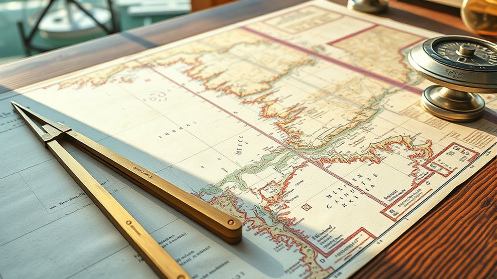
Understanding how to read coastal charts and tide tables is essential for safe and effective steering along the shoreline. When you’re guiding near coastlines, mastering these tools allows you to plan your route accurately, avoid hazards, and guarantee a smooth voyage. Coastal charts are detailed maps that provide critical information about the seafloor, navigational aids, and hazards, while tide tables tell you how the sea level changes throughout the day. Together, they form the backbone of maritime navigation in coastal waters.
One of the first skills you need is interpreting chart symbols. These symbols are standardized and indicate everything from buoys and lighthouse locations to rocks, wrecks, and depths. For example, a symbol representing a lighthouse might be a small black circle with a line radiating outward, while a buoy might be shown as a yellow or green shape depending on its purpose. Recognizing these symbols quickly will help you identify safe passages, navigational aids, and potential hazards. The chart legend explains what each symbol means, so familiarizing yourself with it makes reading charts more intuitive and reduces the risk of misinterpretation.
Alongside understanding chart symbols, you should pay attention to depth contours and soundings. Depths are usually marked in meters or feet, indicating the water’s depth at specific points. When planning your route, always consider the shallowest depths to avoid grounding, especially if you’re operating a vessel with a fixed draft. The chart also indicates tide stations and tidal streams, which are vital for understanding how water levels change. This is where tide tables come into play. They provide predicted high and low tide times and heights, allowing you to plan your passage during safer tide levels. Additionally, understanding how AI-powered tools can assist in real-time navigation updates can enhance safety and efficiency.
Using tide tables effectively means knowing when high or low tides will occur at your location and how these tides influence water depths. For example, a low tide might expose rocks and sandbars that are submerged at high tide, creating navigational hazards. By cross-referencing tide tables with your coastal chart, you can determine the best times to traverse shallow areas or anchor safely. Remember, tides can vary considerably based on lunar cycles and local geography, so always consult the latest data before heading out.
Frequently Asked Questions
How Often Are Coastal Charts Updated for Accuracy?
Coastal charts are typically updated every one to three years through navigation updates and chart revision processes to guarantee accuracy. You should regularly check for the latest updates from official sources like NOAA or other maritime authorities. These updates address changes caused by natural shifts, construction, or new hazards. Staying current with chart revisions helps you navigate safely, avoiding potential dangers and ensuring your charts reflect the most recent information available.
What Symbols Are Most Commonly Used on Coastal Charts?
Many marine navigation maps utilize symbols like buoys, depth contours, and wreck icons to guide you safely. You’ll mostly see symbols such as circles for buoys, triangles for beacons, and lines indicating shoals or channels. To master chart symbol interpretation, focus on understanding these common signs, which streamline safe sailing. Keep practicing, and you’ll quickly decode coastal charts, ensuring confident, clear navigation across complex coastlines.
How Can I Interpret Tide Height Variations Accurately?
You can interpret tide height variations accurately by understanding the tide cycle, which shows how tides rise and fall throughout the day. Use chart symbols to identify high and low tide points, noting their heights and times. Pay attention to the pattern over several days to predict future tides. This helps you plan safe navigation, avoid hazards, and make informed decisions based on tide height changes.
Are Digital Tide Tables More Reliable Than Printed Ones?
Digital tide tables are generally more reliable than printed ones because of their digital accuracy, providing real-time updates and precise data. You might prefer digital versions for their convenience and ability to customize information, making planning easier. Imagine the contrast: printed tables sit static on a page, while digital tools adapt instantly to changing conditions. Ultimately, your choice depends on your user preferences, blending technology’s precision with your needs for safety and convenience.
What Safety Precautions Should I Take When Using Tide Information?
When using tide information, you should always perform a risk assessment to identify potential hazards, like sudden changing water levels. Make certain you’re prepared for emergencies by carrying a reliable communication device, knowing the local coastline, and understanding tide schedules. Keep an eye on weather conditions, and never rely solely on tide tables. Being proactive helps you avoid dangerous situations and guarantees your safety when steering coastal areas.
Conclusion
Mastering coastal charts and tide tables is like learning to read the whispers of the sea. With each chart and tide table, you hold a map to nature’s silent symphony, guiding you safely through shifting currents and rising waters. When you trust these tools, you become a sailor of knowledge, dancing effortlessly with the ocean’s rhythms. Embrace them, and let the tides reveal their secrets, turning every voyage into a harmonious voyage across nature’s liquid canvas.