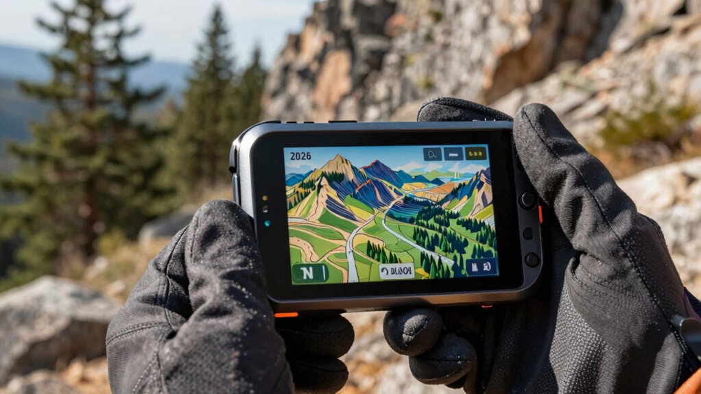

Searching for a handheld GPS with topo maps means looking for reliable navigation tools suited for outdoor activities like hiking, hunting, or trail running. The best models combine rugged durability with detailed topographic mapping, helping you traverse challenging terrain with confidence. The Garmin eTrex 32x stands out as the top overall pick for its balance of features and affordability. The Garmin GPSMAP 66s offers a robust display and multi-GNSS support, making it an excellent choice for serious adventurers. However, these devices often involve tradeoffs between screen size, battery life, and price. Keep reading to see how these options compare and find the best fit for your outdoor needs.

Get garden gear delivered free — and shop member deals
- Fast, free delivery on millions of items
- Access to Prime Big Deal Days deals on October 6–7
- Prime Video, Amazon Music and more included
Complete the kit


Key Takeaways
- Top-ranking models like the Garmin eTrex 32x balance ruggedness and detailed topo mapping at an accessible price.
- Display size and readability vary significantly, affecting usability in bright sunlight or challenging conditions.
- Multi-GNSS support and satellite connectivity are critical for accuracy in remote areas, but may increase cost and complexity.
- Battery life remains a key factor; more advanced features often drain power faster, requiring careful consideration.
- Price ranges from budget-friendly to premium, so selecting the right features depends heavily on your intended outdoor activities.
| Garmin eTrex 32x Rugged Handheld GPS Navigator |  | Best Overall for Durability and Versatile Mapping | Screen Size: 2.2 inches | Display Resolution: 240 x 320 | Map Type: Topographical | VIEW ON AMAZON | See Our Full Breakdown |
| Garmin GPSMAP 65s Handheld GPS with Altimeter and Compass, 2.6″ Color Display |  | Best for Multi-Band GNSS and Public Land Maps | Screen Size: 2.6 inches | Display Type: LCD | Display Resolution: 160 x 240 | VIEW ON AMAZON | See Our Full Breakdown |
| Garmin GPSMAP 66s Handheld Hiking GPS with 3-Inch Color Display and Multi-GNSS Support |  | Best for Large Display and Satellite Imagery | Display: 3-inch color display | Display Resolution: 240 x 400 | Satellite Support: GPS, GLONASS, Galileo | VIEW ON AMAZON | See Our Full Breakdown |
| Garmin eTrex SE GPS Handheld Navigator |  | Best for Long Battery Life and Multi-GNSS Support | Screen Size: 2.2 inches | Display Resolution: 480 x 272 | Battery Life: 168 hours | VIEW ON AMAZON | See Our Full Breakdown |
| Garmin GPSMAP 66i Handheld GPS and Satellite Communicator |  | Best for Safety and Emergency Communication in Remote Areas | Screen Size: 3 inches | Display Resolution: 240 x 400 | Battery Life: 35 hours | VIEW ON AMAZON | See Our Full Breakdown |
| Garmin eTrex 10 Worldwide Handheld GPS Navigator |  | Best Budget-Friendly Basic GPS with Topo Support | Compatible with Vehicle Type: Car, Truck, Motorcycle, etc. | Screen Size: 2.2 inches | Additional Features: Paperless Geocaching, Track More Satellites | VIEW ON AMAZON | See Our Full Breakdown |
| Garmin GPSMAP 65 Handheld GPS with Expanded Satellite Support and Topo Maps |  | Best for Dense Environments with Accurate Topo Mapping | Screen Size: 2.6 inches | Display Type: LCD | Display Resolution: 160 x 240 | VIEW ON AMAZON | See Our Full Breakdown |
| Garmin Montana 710 GPS Handheld Navigator |  | Best for Large Screen and Versatile Mapping | Display: 5-inch color touchscreen | Water Resistance: IPX7 | Shock Resistance: MIL-STD 810 | VIEW ON AMAZON | See Our Full Breakdown |
| Garmin Montana 750i Rugged GPS Handheld with inReach Satellite Technology and 8MP Camera |  | Best for Safety and Image Capture on the Go | Display: 5-inch color touchscreen | Camera: 8-megapixel | Satellite Technology: inReach with two-way messaging and SOS | VIEW ON AMAZON | See Our Full Breakdown |
| S190 Handheld GPS Navigator with 3-Axis Compass and 64GB Storage |  | Best for Long-Duration Extended Trips | Screen Size: 3.2 inches | Display Type: LCD | Battery Life: 36 hours | VIEW ON AMAZON | See Our Full Breakdown |
| Garmin GPSMAP 64sx Handheld GPS with Altimeter and Compass |  | Best Overall for Rugged, Multi-Satellite Navigation | Display: 2.6-inch sunlight-readable color display | Maps: Preloaded TopoActive maps (U.S. and Australia) | Connectivity: Bluetooth and ANT+ | VIEW ON AMAZON | See Our Full Breakdown |
| Handheld GPS for Hiking, Waterproof and Rugged Navigator with 3.2″ Sunlight Readable Screen |  | Best for Long-Duration Hikes with Bright Display | Screen Size: 3.2 inches | Display Type: LCD sunlight-readable | Map Types: U.S. Topo maps preloaded | VIEW ON AMAZON | See Our Full Breakdown |
| Garmin eTrex 22x Handheld GPS Navigator |  | Best Budget-Friendly Rugged GPS for Basic Navigation | Display: 2.2-inch sunlight-readable color display | Resolution: 240 x 320 pixels | Maps: Preloaded Topo Active maps | VIEW ON AMAZON | See Our Full Breakdown |
| handheld gps with topo map | Battery Life | Screen Size |
|---|---|---|
| Garmin eTrex 32x Rugged Handhe | up to 25 hours | 2.2 inches |
| Garmin GPSMAP 65s Handheld GPS | 16 hours | 2.6 inches |
| Garmin GPSMAP 66s Handheld Hik | — | — |
| Garmin eTrex SE GPS Handheld N | 168 hours | 2.2 inches |
| Garmin GPSMAP 66i Handheld GPS | 35 hours | 3 inches |
| Garmin eTrex 10 Worldwide Hand | — | 2.2 inches |
| Garmin GPSMAP 65 Handheld GPS | 16 hours | 2.6 inches |
| Garmin Montana 710 GPS Handhel | Up to 24 hours | — |
| Garmin Montana 750i Rugged GPS | — | — |
| S190 Handheld GPS Navigator wi | 36 hours | 3.2 inches |
| Garmin GPSMAP 64sx Handheld GP | Up to 16 hours | — |
| Handheld GPS for Hiking | 36 hours | 3.2 inches |
| Garmin eTrex 22x Handheld GPS | Up to 25 hours | — |
More Details on Our Top Picks
Garmin eTrex 32x Rugged Handheld GPS Navigator
The Garmin eTrex 32x stands out for its rugged build and detailed preloaded Topo Active maps, making it a reliable choice for serious outdoor enthusiasts. Compared with the GPSMAP 66s, the 32x offers a more durable design, though its smaller 2.2-inch display may be less comfortable for extended viewing. Its support for GPS and GLONASS ensures precise positioning, and the long battery life of up to 25 hours makes it suitable for multi-day trips. The inclusion of a 3-axis compass and barometric altimeter enhances navigation accuracy in challenging terrain. However, its limited internal storage, requiring microSD expansion for additional maps, might be a drawback for those needing extensive data. This device makes the most sense for hikers and cyclists who prioritize durability and detailed topo data without a need for advanced connectivity features.
Pros:- Rugged, water-resistant design suitable for tough outdoor conditions
- Preloaded with detailed Topo Active maps for versatile navigation
- Supports multiple satellite systems for accurate positioning
Cons:- Small 2.2-inch screen may limit map viewing comfort
- Requires AA batteries, which may need frequent replacement
- Limited internal storage without microSD expansion
Best for: Backcountry hikers and cyclists needing a tough device with reliable mapping and long battery life
Not ideal for: Urban users or casual walkers who prefer larger screens or built-in rechargeable batteries
- Screen Size:2.2 inches
- Display Resolution:240 x 320
- Map Type:Topographical
- Memory Storage Capacity:8 GB
- Battery Life:up to 25 hours
- Supported Satellite Systems:GPS and GLONASS
Our verdict“Ideal for serious outdoor users who need durability and reliable topo maps in challenging environments.”
Garmin GPSMAP 65s Handheld GPS with Altimeter and Compass, 2.6″ Color Display
The Garmin GPSMAP 65s offers an excellent balance of ruggedness and advanced navigation features, with its high-visibility 2.6-inch color display and multi-band GNSS support. Compared to the GPSMAP 66s, the 65s’s focus on multi-band accuracy ensures better performance in heavily wooded or canyon environments, though it lacks the larger display size. Its preloaded topographic maps and public land boundary data make it a strong choice for hunters and campers. While the resistive touchscreen may feel less responsive than capacitive screens, its robust design and reliable multi-satellite support make it ideal for extended outdoor use. The limited information on pricing means it appeals most to those who value precise positioning over extra features like weather updates. Overall, this device is best suited for outdoor adventurers who need accurate location data in challenging conditions.
Pros:- Robust, weather-resistant construction for outdoor durability
- Multi-band GNSS support for high-accuracy positioning in difficult environments
- Preloaded topographic and public land boundary maps
Cons:- Resistive touchscreen may be less responsive than capacitive alternatives
- No detailed information on battery life limits extended use possibilities
- Lack of built-in subscription services for additional maps or imagery
Best for: Hunters and campers requiring multi-band GNSS and detailed land boundary data
Not ideal for: Urban explorers or casual users who prefer larger, more responsive screens or integrated weather features
- Screen Size:2.6 inches
- Display Type:LCD
- Display Resolution:160 x 240
- Memory Storage:16 GB
- Battery Life:16 hours
- Supported Satellite Navigation System:GPS
Our verdict“Best for users needing high-precision multi-band GNSS support in rugged outdoor settings.”
Garmin GPSMAP 66s Handheld Hiking GPS with 3-Inch Color Display and Multi-GNSS Support
The Garmin GPSMAP 66s excels with its large 3-inch sunlight-readable display, making map reading easier in bright outdoor conditions. It supports multiple satellite systems including GPS, GLONASS, and Galileo, providing reliable navigation in complex terrains. Compared with the GPSMAP 65s, the 66s’s size offers better visual clarity, while its preloaded TOPO maps and BirdsEye Satellite Imagery elevate its navigation capabilities. Wireless features for weather updates and geocaching add versatility. The main tradeoff is its potentially higher price and the fact that some users might find the size less pocket-friendly. If you want a device with a bigger screen and integrated satellite imagery, this model is a prime choice for serious outdoor travelers. However, its renewed condition may affect some buyers’ confidence.
Pros:- Large, sunlight-readable 3-inch display for easy map viewing
- Supports multiple satellite systems for high accuracy
- Includes BirdsEye Satellite Imagery for enhanced navigation
Cons:- Refurbished condition may vary in reliability
- Higher price point compared to smaller or less feature-rich models
- Potentially less portable due to larger size
Best for: Outdoor enthusiasts who prioritize a large, easy-to-read display and satellite imagery
Not ideal for: Those seeking a budget-friendly or compact device for casual use
- Display:3-inch color display
- Display Resolution:240 x 400
- Satellite Support:GPS, GLONASS, Galileo
- Maps:Preloaded TOPO U.S. and Canada
- Connectivity:Wireless, Active Weather
- Additional Features:BirdsEye Satellite Imagery
Our verdict“Great for users who need a sizable display and detailed satellite imagery for in-depth exploration.”
Garmin eTrex SE GPS Handheld Navigator
The Garmin eTrex SE offers an impressive 168 hours of battery life, making it ideal for extended outdoor excursions. Its support for multiple GNSS systems, including BeiDou and QZSS, ensures dependable tracking even in challenging environments. Compared with the more feature-rich GPSMAP 66s, the eTrex SE provides a simpler interface and longer-lasting power, though its smaller 2.2-inch display limits detailed map viewing. Its water-resistant design adds to outdoor resilience, and compatibility with the Garmin Explore app allows wireless updates and geocaching. The main tradeoff involves the need to purchase separate batteries, which could be inconvenient. This device suits outdoor enthusiasts who prioritize longevity and multi-system support over large screens or advanced features.
Pros:- Exceptional battery life for multi-day trips
- Supports multiple satellite systems for reliable tracking
- Water-resistant and durable design
Cons:- Requires 2 AA batteries, which must be purchased separately
- Small screen size limits detailed map viewing
- No built-in rechargeable battery
Best for: Backcountry explorers needing long-lasting power and multi-GNSS capabilities
Not ideal for: Urban users or those who prefer rechargeable devices with larger displays
- Screen Size:2.2 inches
- Display Resolution:480 x 272
- Battery Life:168 hours
- Supported Satellite Systems:GPS, GLONASS, Galileo, BeiDou, QZSS
- Water Resistance:IPX7
Our verdict“Perfect for users who need a durable device with extended battery life and multi-GNSS support for long adventures.”
Garmin GPSMAP 66i Handheld GPS and Satellite Communicator
The Garmin GPSMAP 66i combines rugged navigation with satellite communication, making it a top choice for those venturing into remote areas. Its 3-inch sunlight-readable display provides clear mapping, supported by preloaded TOPO maps and satellite imagery. Compared to the GPSMAP 66s, the 66i adds two-way messaging and SOS capabilities via Iridium satellite network, offering peace of mind in emergencies. The device supports multiple GNSS systems, ensuring accurate positioning. Its 35-hour battery life supports multi-day adventures, but the subscription cost for satellite texting and potential restrictions on satellite use in some jurisdictions are notable drawbacks. This model appeals most to backcountry explorers, mountaineers, or outdoor workers needing reliable navigation plus satellite-based safety features.
Pros:- Rugged, weather-resistant design suitable for extreme conditions
- Preloaded TOPO maps and satellite imagery for detailed navigation
- Satellite communication with SOS and messaging functions
Cons:- Requires subscription for satellite texting and messaging
- Higher cost due to inReach technology
- Some jurisdictions may restrict satellite communication use
Best for: Remote area travelers who require GPS and satellite communication for safety
Not ideal for: Casual hikers or urban users who do not need satellite messaging or SOS features
- Screen Size:3 inches
- Display Resolution:240 x 400
- Battery Life:35 hours
- Supported Satellite Navigation System:GPS, GNSS
- Additional Features:Interactive SOS, Satellite Texting
Our verdict“Best suited for adventure seekers who need navigation plus reliable satellite communication for safety.”
Garmin eTrex 10 Worldwide Handheld GPS Navigator
The Garmin eTrex 10 stands out for offering reliable basic navigation at a very accessible price point, especially for those new to outdoor GPS devices. It features a monochrome LCD that, while less detailed than color screens like the Garmin GPSMAP 65, keeps the device simple and easy to read in bright sunlight. Its preloaded worldwide basemap makes it suitable for global use but lacks detailed topo maps, making it less ideal for precise terrain navigation compared to more advanced models like the Garmin Montana 710. The long battery life of up to 20 hours is a significant advantage for extended trips, though its limited internal storage (6 MB) restricts map data. This device is best suited for casual hikers and beginners who prioritize durability and affordability over advanced features.
Pros:- Rugged and waterproof design suitable for outdoor activities
- Long battery life of up to 20 hours with AA batteries
- Preloaded worldwide basemap simplifies initial use
Cons:- Monochrome display offers less detail than color screens
- Limited internal storage restricts map data and upgrades
Best for: Budget-conscious outdoor enthusiasts or beginners needing reliable basic navigation
Not ideal for: Experienced hikers or hunters requiring detailed topo maps and advanced features
- Compatible with Vehicle Type:Car, Truck, Motorcycle, etc.
- Screen Size:2.2 inches
- Additional Features:Paperless Geocaching, Track More Satellites
- Connectivity Technology:USB
- Map Types:Australia
- Battery Average Life:20 hours
- Display Type:LCD
- Supported Satellite Navigation System:GPS
Our verdict“This GPS is ideal for newcomers or casual users seeking a straightforward, durable device at an affordable price.”
Garmin GPSMAP 65 Handheld GPS with Expanded Satellite Support and Topo Maps
The Garmin GPSMAP 65 makes a clear leap forward with multi-band GNSS support, which provides better accuracy in challenging environments like urban canyons or dense forests compared with the Garmin eTrex 10. Its 2.6-inch sunlight-readable color display makes reading maps and terrain features easier in bright conditions, unlike the monochrome eTrex 10. Preloaded TopoActive maps and public land boundaries make it a strong option for those who need detailed terrain data without extra downloads, but the device’s focus on North America limits its global versatility. The absence of built-in Wi-Fi for updates means managing maps requires a wired connection, which could be inconvenient. Overall, it suits more experienced outdoor users who need reliable, detailed topo maps and strong satellite performance.
Pros:- Enhanced multi-band GNSS for superior accuracy in difficult environments
- Preloaded with detailed TopoActive maps and land boundaries
- Sunlight-readable 2.6-inch color display
Cons:- Limited to North America map support
- No built-in Wi-Fi for direct map updates
Best for: Hikers and hunters navigating complex terrains in North America
Not ideal for: International travelers or casual day hikers who don’t need advanced GNSS support
- Screen Size:2.6 inches
- Display Type:LCD
- Display Resolution:160 x 240
- Battery Life:16 hours
- Connectivity:Bluetooth, ANT+
- Supported Maps:TopoActive, Federal Public Land Map
Our verdict“This device is best for users who need precise positioning and detailed topo maps in the U.S. and Canada.”
Garmin Montana 710 GPS Handheld Navigator
The Garmin Montana 710 offers a significant upgrade with its 5-inch glove-friendly color touchscreen, making it ideal for users who prefer larger displays for detailed terrain views—a feature not available on the smaller Garmin GPSMAP 65. Its rugged build with IPX7 water resistance and MIL-STD 810 shock resistance ensures durability in tough outdoor conditions. The device supports multiple map downloads, including TopoActive, City Navigator, and BlueChart, catering to diverse outdoor activities like hiking and boating. Its long 24-hour battery life helps sustain longer adventures, but the requirement for additional mounts and the need for a subscription for premium maps can add to costs. This model fits users who want a large, versatile touchscreen for extensive navigation tasks.
Pros:- Large 5-inch glove-friendly touchscreen for easy navigation
- Supports multiple map downloads and satellite imagery
- Long battery life of up to 24 hours
Cons:- Additional mounting accessories are sold separately
- Premium map downloads require extra subscriptions
Best for: Hikers, boaters, and outdoor enthusiasts needing a large, adaptable screen
Not ideal for: Minimalists or those seeking lightweight devices for quick trips
- Display:5-inch color touchscreen
- Water Resistance:IPX7
- Shock Resistance:MIL-STD 810
- Memory:32 GB
- Battery Life:Up to 24 hours
Our verdict“This GPS is perfect for users who want a sizable, rugged device capable of supporting diverse mapping needs during extended outdoor activities.”
Garmin Montana 750i Rugged GPS Handheld with inReach Satellite Technology and 8MP Camera
The Garmin Montana 750i combines a large 5-inch touchscreen with inReach satellite technology, making it a top choice for safety-conscious adventurers who need global two-way messaging and SOS. Its built-in 8MP camera adds the ability to document trips, a feature absent in most competing models like the Garmin Montana 710. The device supports multiple GNSS systems, providing reliable positioning across various terrains, but the active satellite subscription for inReach features adds ongoing cost. Its rugged construction with military-grade durability makes it suitable for extreme conditions, although the high price point could be a barrier for casual users. If safety and documentation are priorities, this device offers unmatched capabilities.
Pros:- Rugged, military-grade construction for tough environments
- Built-in 8MP camera for capturing images
- Global satellite messaging and SOS for safety
Cons:- Active satellite subscription required for inReach features
- High price makes it less accessible for casual users
Best for: Outdoor professionals, hunters, or travelers needing safety features and photo documentation
Not ideal for: Budget travelers or casual hikers not requiring satellite communication or camera features
- Display:5-inch color touchscreen
- Camera:8-megapixel
- Satellite Technology:inReach with two-way messaging and SOS
- Navigation Support:Multi-GNSS
- Water Resistance:IPX7
Our verdict“This device is best suited for users who prioritize safety, communication, and photo documentation in remote areas.”
S190 Handheld GPS Navigator with 3-Axis Compass and 64GB Storage
The S190 offers a sizable 3.2-inch LCD screen with a rugged design suitable for demanding outdoor use, similar in purpose to the Garmin Montana 710 but with a focus on storage capacity. Its impressive 64GB internal storage allows for extensive maps and data, making it ideal for lengthy hikes or camping trips where multiple topo maps are needed. Supporting multiple satellite systems like GPS, Galileo, QZSS, and BeiDou enhances positional accuracy, especially in remote locations. However, the smaller screen size and limited zoom without additional map downloads might challenge users seeking quick, detailed terrain views, unlike the Montana 710’s larger display. It’s best for those who prioritize map capacity and battery life over screen size.
Pros:- Large 64GB internal storage for extensive maps
- Supports multiple satellite systems for high accuracy
- Long 36-hour battery life for extended trips
Cons:- Small screen size may limit ease of terrain reading
- Limited zoom levels without additional map downloads
Best for: Long-distance hikers or campers needing extensive map storage and multi-system support
Not ideal for: Casual users or those preferring larger, easier-to-read screens for quick navigation
- Screen Size:3.2 inches
- Display Type:LCD
- Battery Life:36 hours
- Storage Capacity:64 GB
- Supported Satellite Systems:GPS, Galileo, QZSS, BeiDou
Our verdict“This GPS is well-suited for users who need enormous map capacity and multi-system support for lengthy outdoor adventures.”
Garmin GPSMAP 64sx Handheld GPS with Altimeter and Compass
The Garmin GPSMAP 64sx stands out for its durability and comprehensive navigation features, making it ideal for serious outdoor enthusiasts. Compared to the Garmin eTrex 22x, it offers a larger, sunlight-readable color display, which improves visibility in bright conditions. Its support for multiple satellite systems (GPS, GLONASS, Galileo) ensures more reliable positioning, especially in challenging environments. The preloaded TopoActive maps cover the U.S. and Australia, but this limited geographic scope may be a drawback for global adventurers. The rugged, water-resistant design and long 16-hour battery life make it suitable for extended trips. However, its small screen size and preloaded maps confined to two regions could limit flexibility. This model makes the most sense for users who prioritize durability and multi-satellite support in remote conditions.
Pros:- Durable, water-resistant build suitable for tough environments
- Preloaded with detailed TopoActive maps for the U.S. and Australia
- Supports multiple satellite systems for highly accurate positioning
- Long battery life of up to 16 hours
Cons:- Limited to U.S. and Australian maps preloaded; no global coverage
- Small 2.6-inch display may be hard to read in some situations
Best for: Backcountry explorers and professional outdoor guides needing ruggedness and multi-system accuracy
Not ideal for: Casual hikers or travelers seeking a lightweight, global mapping device with broader coverage
- Display:2.6-inch sunlight-readable color display
- Maps:Preloaded TopoActive maps (U.S. and Australia)
- Connectivity:Bluetooth and ANT+
- Battery Life:Up to 16 hours
- Features:Altimeter, 3-axis compass, multi-GNSS support
- Water Resistance:Water-resistant
Our verdict“This device is best for experienced outdoor users who need rugged durability and multi-GNSS support in remote areas.”
Handheld GPS for Hiking, Waterproof and Rugged Navigator with 3.2″ Sunlight Readable Screen
This compact handheld GPS excels for multi-day hikes and outdoor adventures thanks to its bright 3.2-inch sunlight-readable display and impressive 36-hour battery life. Unlike the Garmin eTrex 22x, which has a smaller 2.2-inch screen and shorter battery span, this model prioritizes usability in bright conditions and extended trips. It supports multiple satellite systems, including BeiDou, GPS, Galileo, and QZSS, ensuring accurate positioning even in difficult terrain. Preloaded with U.S. Topo maps, it’s ready for wilderness exploration but lacks a touchscreen interface, which could slow navigation for some users. Its waterproof rating (IP66) makes it resilient against the elements, but internal memory is limited, restricting additional map options. This pick makes the most sense for hikers who value a large, bright display and long battery life over advanced interface features.
Pros:- Bright, sunlight-readable 3.2-inch display for easy viewing outdoors
- Long battery life of up to 36 hours for multi-day excursions
- Supports multiple satellite systems for precise positioning
- Waterproof (IP66) design withstands tough weather
Cons:- No touchscreen interface, requiring button navigation
- Limited internal storage restricts additional map downloads
- Requires USB-C cable for recharging
Best for: Hikers and campers needing a durable device with excellent visibility and extended battery life
Not ideal for: Urban explorers or casual users who prefer touchscreen interfaces or larger internal storage
- Screen Size:3.2 inches
- Display Type:LCD sunlight-readable
- Map Types:U.S. Topo maps preloaded
- Battery Life:36 hours
- Features:Waterproof IP66, multi-GNSS support
- Connectivity Technology:USB
Our verdict“This device is best suited for serious hikers who need a reliable, long-lasting GPS with a bright display.”
Garmin eTrex 22x Handheld GPS Navigator
The Garmin eTrex 22x offers a straightforward, rugged design with a small 2.2-inch sunlight-readable display, making it ideal for budget-conscious outdoor enthusiasts. When compared to the Garmin GPSMAP 64sx, its compact size and simplicity appeal to those needing a lightweight device that still supports detailed Topo Active maps. While its smaller screen limits detailed map viewing, it compensates with longer battery life of up to 25 hours, powered by AA batteries—convenient for quick replacements in the field. It supports both GPS and GLONASS, enhancing accuracy in challenging environments. However, the small display and lack of touchscreen can be frustrating for users accustomed to modern interface standards, and AA batteries may require frequent replacements during extended trips. This model makes the most sense for casual hikers or beginners who prioritize durability and basic mapping without extra bells and whistles.
Pros:- Rugged, durable design suitable for outdoor use
- Supports GPS and GLONASS for better accuracy
- Preloaded with detailed Topo Active maps
- Long battery life up to 25 hours with AA batteries
Cons:- Small 2.2-inch display limits map detail viewing
- Uses AA batteries, which may require frequent replacements
- No touchscreen interface
Best for: Casual hikers and outdoor beginners on a budget needing reliable basic mapping
Not ideal for: Advanced users or those requiring a large, easy-to-navigate display for detailed topo maps
- Display:2.2-inch sunlight-readable color display
- Resolution:240 x 320 pixels
- Maps:Preloaded Topo Active maps
- Battery Life:Up to 25 hours
- Supported Satellite Systems:GPS and GLONASS
- Power:2 AA batteries
Our verdict“This device is perfect for beginners or budget shoppers who need a reliable, portable GPS with basic topo mapping capabilities.”

How We Picked
The products in this roundup were selected based on their ability to deliver reliable topographic mapping and overall navigation performance. We prioritized devices with durable construction, clear and sunlight-readable screens, and extensive satellite support for accurate positioning. Ease of use, battery life, and value for the price also played a significant role in our evaluation. Devices were ranked considering the versatility for different outdoor activities, feature set, and user feedback, ensuring that each option offers a distinct advantage for specific needs.Factors to Consider When Choosing Handheld Gps With Topo Maps
Choosing the right handheld GPS with topo maps involves balancing several factors beyond just features. Understanding your primary activity—be it hiking, hunting, or trail running—helps narrow down your options. Consider display readability, especially in bright sunlight, as this impacts navigation safety. Battery life is another critical aspect; longer excursions demand longer-lasting power sources. Compatibility with different satellite systems can improve location accuracy in remote areas. Additionally, evaluate whether you need extra features like waterproofing, camera, or satellite communication, which can influence both cost and usability.Display Clarity and Size
A bright, sunlight-readable display makes a significant difference when you’re outdoors, especially in direct sunlight. Larger screens improve visibility and ease of use, particularly when zooming in on topo maps or viewing multiple data points. However, bigger displays often increase device size and battery consumption. Striking a balance between screen size and portability is key, especially if you plan to carry your device for extended periods or in tight spaces like backpack pockets.
Satellite Support and Accuracy
Devices supporting multiple satellite systems, such as GPS, GLONASS, and Galileo, generally provide more accurate positioning in challenging environments like dense forests or deep valleys. This is particularly important for off-trail navigation or remote wilderness trips. However, more satellite support can mean increased device complexity and cost. Users should consider their typical terrain and whether they need the highest possible precision or if basic GPS coverage suffices.
Battery Life and Power Options
Battery longevity varies widely among handheld GPS units, from a few hours to over a day of continuous use. For longer outings, models with replaceable batteries or the ability to connect to portable power sources can extend operational time. Keep in mind that high-brightness screens, frequent map refreshes, and additional features like satellite communication drain power faster. Evaluating your activity duration and power needs can prevent unexpected shutdowns in critical moments.
Build Quality and Durability
Outdoor devices should withstand the elements—water, dust, shocks, and temperature fluctuations. Rugged construction, waterproof ratings, and shock resistance are vital for demanding environments. Cheaper models may lack these features, risking damage or failure in rough conditions. Spending more on a durable device can save money and frustration during prolonged or intense use.
Additional Features and Ease of Use
Extras like preloaded topo maps, microSD card slots for expanded storage, or integrated cameras can enhance your experience. User interface design and menu simplicity also matter; complicated setups can hinder quick navigation when needed most. Carefully consider which features genuinely add value for your typical activities, avoiding overpaying for bells and whistles that won’t be used often.
Frequently Asked Questions
Do I need a GPS with satellite communication or inReach technology?
If you venture into remote areas without cell service, a GPS with satellite communication or inReach technology can be a lifesaver. These features allow you to send messages or request help even when offline. However, they come with higher costs and often require subscription plans. For most recreational users, traditional GPS with topo maps and good satellite support offers sufficient navigation reliability.
How important is map detail versus battery life?
More detailed maps and larger screens typically consume more power, reducing battery life. If you plan long trips without access to charging, prioritizing a device with longer battery life over maximum map detail may be wise. Conversely, for shorter, detail-oriented excursions, sharper maps can enhance navigation without drastically impacting overall use time.
Can I load my own topo maps onto these devices?
Most modern handheld GPS units support custom topo maps, either through microSD cards or internal memory. This flexibility allows you to tailor maps for specific regions or activities, potentially saving money over preloaded options. Always verify compatibility with your chosen device before purchasing additional maps, and consider ease of map installation and updating.
Are these devices suitable for water activities?
Many handheld GPS units are designed to be waterproof or water-resistant, making them suitable for kayaking, fishing, or rain-soaked hikes. Check the specific IP rating or waterproof standard for each model to confirm suitability. Keep in mind that even water-resistant devices should be handled carefully to avoid damage in extreme conditions.
Is touchscreen or button navigation better for outdoor use?
Touchscreens offer intuitive map interaction but can be less responsive in wet or cold conditions. Physical buttons provide more reliable navigation under challenging weather and when wearing gloves. Consider your typical outdoor environment—if weather conditions are often wet or cold, a device with physical controls may provide a better experience.
Conclusion
The best overall handheld GPS with topo maps for most users is the Garmin eTrex 32x, thanks to its balanced mix of durability, map detail, and affordability. For those prioritizing accuracy in remote areas, the Garmin GPSMAP 66s offers advanced satellite support and a larger, clearer display. Beginners or casual hikers might prefer the Garmin eTrex 22x for its simplicity and straightforward use. Serious outdoor enthusiasts who want premium features like inReach satellite communication should consider the Garmin Montana 750i. Ultimately, your choice depends on your activity level, terrain, and budget, but this list provides a clear starting point for every type of adventurer.
As an affiliate, we earn on qualifying purchases.Evergreen bestsellers Picks
bestsellers